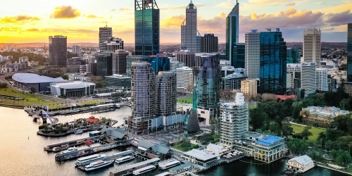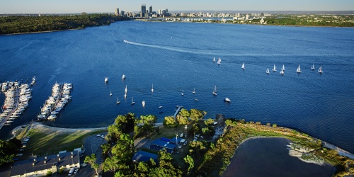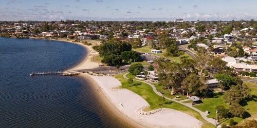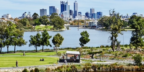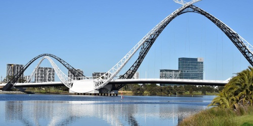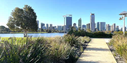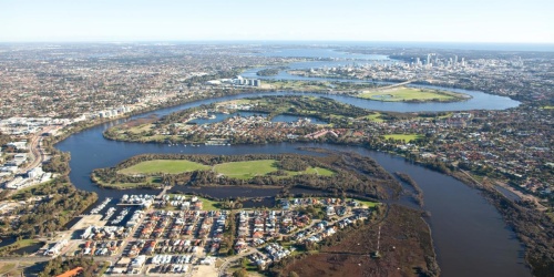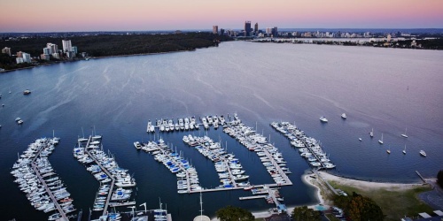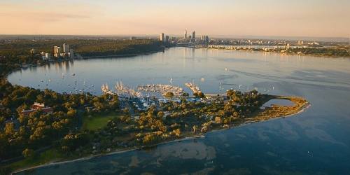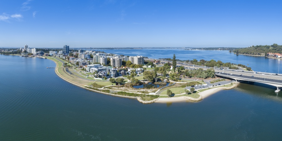
Aerial view of the South Perth foreshore. Photo by Tourism WA
The policies, plans and guidelines provide direction and guidance on what information DBCA considers when assessing an application for permits, land use planning and development within, abutting, or affecting the Swan Canning Development Control Area (DCA). It is recommended that you review the documents linked in this web page before preparing your application.
More information on the DCA, including how to find out if your property is affected by the DCA, is available on the Swan Canning Development Control Area page.
A copy of each policy, plan and guideline is available to download below. To help you find which documents are most relevant to you, there is also a summary of each document: what they cover, and when they apply.
The Determination Processes document outlines the statutory planning responsibilities of the Department of Biodiversity, Conservation and Attractions and the Swan River Trust in relation to the DCA. It details the determination processes associated with the SCRM Act and SCRM Regulations and those proposals subject to control under the Metropolitan Region Scheme. A copy of the Determination Processes is available in the download section below.
Policies
State Planning Policy 2.9 Water
State Planning Policy 2.9 Water and the Planning for Water Guidelines should be considered when planning for land use changes or preparing applications for subdivision and/or development within, abutting or affecting the DCA.
Policy 42 - Planning for land use, development and permitting affecting the Swan Canning development control area
Policy 42 should be referred to when planning for land use changes or preparing applications for subdivision and development that are in, or affecting, the DCA. As well as permit applications for works, acts and activities in the DCA.
This policy covers:
- Ecological health
- Landscape protection
- Recreational opportunities and public access
- River foreshores
- Flood prone land
- Heritage
Consider before applying:
Proposals must demonstrate that they do not, either directly or indirectly, unacceptably degrade shallow river flats, foreshore vegetation, fringing wetlands, saltmarshes or tributaries associated with the Swan Canning river system.
Policy 43 - Planning for marinas, yacht clubs and aquatic clubs in the Swan Canning development control area
This policy covers:
- Planning and land tenure for marinas, yacht clubs and other aquatic clubs and their facilities around the rivers
- Marinas and yacht clubs
- Aquatic club buildings and facilities
- Public access
- Car parking
- Signage
- Lighting
- Clubs and associations
- Maintenance of facilities
Consider before applying:
DBCA does not support the development of new marinas and yacht clubs on the river system.
Policy 44 - Planning for jetties in the Swan Canning development control area
This policy covers:
- Planning and land tenure for jetties
- Jetty design
- Floating boat lifts
- Construction
- Maintenance
- Temporary jetty structures
- Transfer of jetty structures
Consider before applying:
DBCA encourages and supports the maintenance of existing private jetties in the river system to ensure ongoing safe use and amenity. It does not support the development of new private jetties or the extension of existing private jetties in the river system.
As the population of Perth grows, the river system faces pressures from increased use and development, including requests for jetties.
Applications for jetties are to demonstrate a public benefit by contributing to the long-term community use and enjoyment of the river system without unacceptably affecting its ecological health, or amenity. While DBCA recognises the importance of jetties in providing access to the river system, a proliferation of such structures may detract from the amenity of the river system as a whole and have the potential to alienate public access.
Appropriately designed and located public and commercial jetties form an integral part of the river system setting and are an important recreational and tourist resource.
Policy 45 - Planning for miscellaneous structures and facilities in the Swan Canning development control area
This policy covers:
- Bridges
- Groynes and headlands
- Riverbank stabilisation and river retaining walls
- Car parking and access roads
- Boardwalks and pathways for pedestrians and/or cyclists
- Landfills
- Fuel storage
- Sullage pump-out
- Signage
- Telecommunications infrastructure
- Dinghy, tender or small vessel storage facilities
- Co-location of infrastructure
- Fireworks displays and lighting installations
- Other miscellaneous structures
Consider before applying:
Miscellaneous structures and facilities in the DCA require development or permit approval and may require a lease.
Policy 46 - Planning for commercial operations in the Swan Canning development control area
Policy 46 should be referred to when preparing applications for commercial facilities or operations in the DCA such as (but not limited to):
- Restaurants
- Cafes
- Tearooms
- Kiosks
- Mobile food vans
- Short stay accommodation
- Watercraft lessons or hire
- Charter vessels
- Floatplanes and other aircraft;or
- Vending
'Commercial' means direct financial gain or reward.
This policy covers:
- Planning and land tenure
- Development of food and beverage facilities on land
- Development of food and beverage facilities over waters
- Mobile food vans
- Development of short-stay accommodation
- Commercial watercraft operations (charter vessels, hire, lessons)
- Commercial aviation (helicopters, float/seaplanes)
- Vending
- Signage
- Temporary trial operations
- Maintenance of facilities
- Other commercial facilities and operations
Consider before applying:
Commercial activities cannot operate on the river without:
- A registered ABN
- Public liability insurance (minimum $20,000,000 coverage)
- Certificate of survey (for vessels)
- Certificate of Operation (unless exempt)
Policy 47 - Planning for dredging in the Swan Canning development control area
Policy 47 applies to applications for new dredging and maintenance dredging. It provides guidance to applicants and other decision-making authorities regarding DBCA’s position on appropriate dredging in the DCA. This Policy covers:
- Justification for dredging
- Potential impacts of dredging
- Dredge spoil
- Management and monitoring of dredging activities
- Maintenance dredging
Consider before applying:
DBCA will require any applications for dredging to demonstrate that alternatives to dredging have been explored.
Dredging in the DCA required development or permit approval.
Policy 48 - Planning for development setback requirements affecting the Swan Canning development control area
Development and land use changes abutting the DCA require approval from the Western Australian Planning Commission (WAPC) or the local government on advice from the DBCA.
Applicants should have regard for Policy 48 when planning and preparing applications for subdivision and development that are around or may affect the DCA.
This policy details setback requirements that apply to solid and hard-facing structures such as:
- dwellings
- sheds
- garages
- above-ground swimming pools
- covered or enclosed balconies
- solid walls with a total height exceeding 1 metre from the natural ground level
It provides setback requirements for the development of residential, rural, and other land, including survey-strata and strata-titled land, and details how setbacks should accommodate roads and floodplains. It also includes setback provisions for retaining walls and fencing, outdoor living areas, car parking areas, and landscaping.
What does this policy cover?
- General development setback requirements from the boundary of the DCA
- Setback requirements in Urban zoned land for residential development
- Setback requirements in Urban (developed for purposes other than residential), Industrial and Public
- Purposes zoned land
- Setback requirements for Rural zoned land
- Bulk, scale and style of development
- Subdivisions, survey-strata and strata lots
- Public roads
- Floods and sea level rise
- Boundary fences
- Ground levels and retaining walls
- Outdoor living areas and car parking areas
- Landscaping within setback areas
Consider before applying:
Setback and fencing:
- On Urban zoned land, the minimum setback is to be 10 metres or 20 per cent of the average depth of the lot, whichever is the lesser, from the DCA boundary.
- This policy also requires ‘open-view’ fencing along the boundary of the P&R reserve.
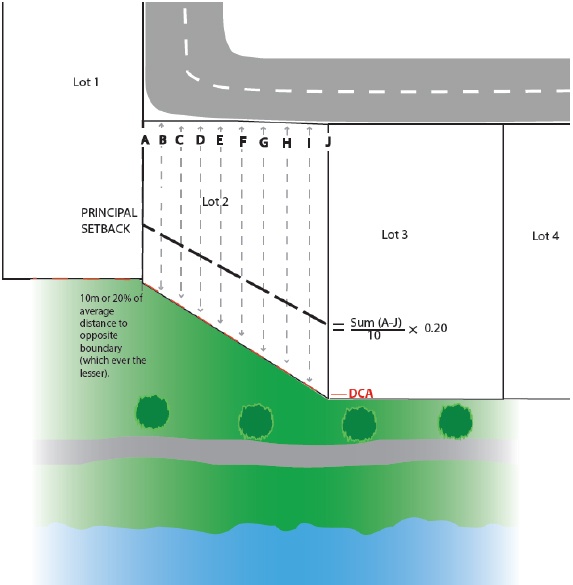
Figure 1 How to establish the average principal setback
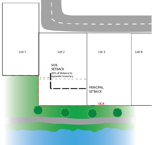
Figure 2 How to establish the side setback
Retaining walls:
- Where possible, proposed ground levels should match the existing natural contours. Graduated levels are preferred instead of abrupt topographic changes and obtrusive retaining wall structures, which would dominate the river setting and its landscape.
- To minimise the landscape impact of retaining walls, wall heights should be minimised. Retaining should be based on the average height of the land and where possible result in equal cut to fill and not increase the height of the land above the river.
- Retaining walls are to be setback at least three metres from the P&R reserve, except where retaining is less than one metre total height and forms the solid portion of an open style boundary fence.
- Retaining walls are not to exceed an individual height of one metre and a total combined height of three metres from the natural ground level at the P&R reserve boundary.
- Where more than one retaining wall is proposed, a minimum one metre separation distance is required between the face of each retaining wall, which is to be planted with native shrubs to soften the visual impact.
- The colours and material of the wall should be harmonised with the river environment when being viewed from the adjacent public reserve.
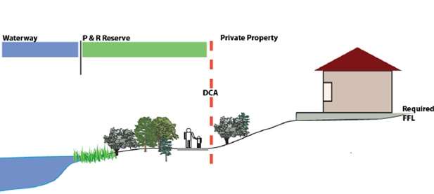
Figure 3 Graduated ground level is preferred
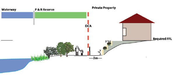
Figure 4 Terracing of retaining walls
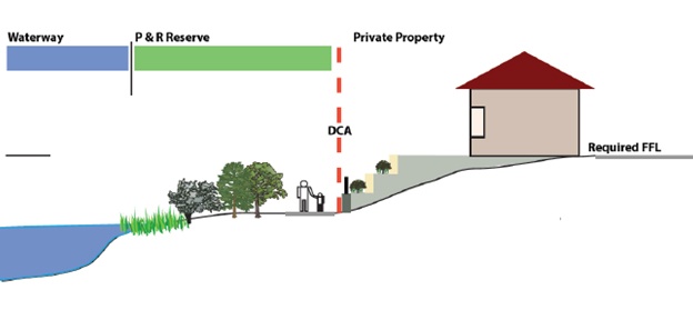
Figure 5 Terracing of retaining walls only where site constraints exist
Policy 49 - Planning for stormwater management affecting the Swan Canning development control area
The objective of this Policy 49 is to ensure land use, development, and other permitted works, acts and activities that comprise, include or use stormwater management systems in or affecting the Swan Canning Development Control Area (DCA) do not result in further water quality degradation of the Swan Canning river system, and where possible, improve the situation.
This policy covers:
- Land and water planning
- Stormwater quality and quantity
- Contaminated sites and elevated nutrient levels
- Acid sulphate soils
- Controlled groundwater levels and subsoil drains
- Maintenance
- Stormwater management for small-scale urban development proposals
- Stormwater management in the DCA
Consider before applying:
Stormwater management systems are to be designed to protect and enhance the ecological and hydrological functions and amenity of the river system through applying stormwater management measures such as:
- Retaining and installing pervious surfaces wherever practical.
- Stormwater run-off from constructed impervious surfaces generated by small rainfall events (i.e. the first 15 mm of rainfall) must be retained and/or detained and treated (if required) at-source as much as practical and will not be permitted to enter the river untreated.
- Retaining existing tributaries and surface water flow paths.
- Include vegetated overland flow paths to the river system instead of pipes or drains wherever practical.
Policy 50 - Planning for dewatering management affecting the Swan Canning development control area
Dewatering, the process of removing groundwater from an aquifer to lower the water table, particularly during construction and development, is a widespread practice in areas with a shallow groundwater table such as many areas of the Swan Canning catchment.
This includes proposals in and adjacent to the DCA as well as those that may not immediately adjoin the DCA but that may affect waters in the Swan Canning river system through surface and/or groundwater connections.
This policy provides guidance to proponents and other decision-making authorities regarding the department’s position in relation to dewatering. It recognises and refers to other relevant State government policies and provides additional guidance relevant to the Swan Canning river system.
This Policy covers:
- Justification and site context
- Tailwater discharge
- Management and monitoring
- Acid sulphate soils and contaminated sites
- Continuous post-development dewatering
Consider before applying:
DBCA will only support discharge of dewatering tailwater to the river system, either directly or indirectly (e.g. via a stormwater drain) where it can be demonstrated that:
- On-site alternative disposal options have been utilised to the fullest extent practicable. Including, but not limited to:
- groundwater recharge (e.g. infiltration, re-injection);
- re-use (e.g. irrigation, dust control, wash-down);
- storage and evaporation;
- sewer; and
- off-site transport, storage and disposal.
And:
- The water quality of the groundwater and tailwater discharge (pre-and post-treatment) are monitored and the tailwater discharged to the river (directly or indirectly through a stormwater drain) meets the relevant indicative criteria outlined in this policy.
If the above are met, DBCA will require a Dewatering Management Plan that addresses the following:
Prior to the commencement of each dewatering peiod:
- Testing of treated tailwater will need to occur prior to the commencement of ongoing dewatering works to ensure that any treatment is working as anticipated. These results are to be provided to DBCA for approval prior to the commencement of dewatering works.
- It is recommended that background testing of the receiving water body is also undertaken (this should be offshore, away from the river’s edge and existing drainage structures, to avoid any confounding results from stormwater runoff or contaminated drainage).
During dewatering:
- Dewatering works can commence once the treated tailwater water quality results have been approved by DBCA (and, if required, the local government has approved the use of its stormwater infrastructure).
- Ongoing water monitoring will be required every 3-7 days, depending on the duration and nature of the dewatering works. Water quality test results will need to be provided to DBCA to demonstrate that the treatment train is continuing to function as expected.
- If the tailwater is being discharged via a stormwater drain, then the outlet is to be monitored for:
- turbidity during the dewatering works, with contingency methods to contain turbidity if it occurs.
- any signs of scour, with contingency methods to prevent scour and rectify any damage should it occur.
Contingency methods and stop works:
- If the ongoing monitoring results during dewatering indicate that the treatment system is not functioning as expected, the discharge of dewatering tailwater to the river is to cease and effluent to be disposed of offsite until the previously approved water quality results can be demonstrated. The release of dewatering effluent to the river cannot recommence until the treated water quality results have again been approved by DBCA.
- If the dewatering works are resulting in excess turbidity in the river, a silt curtain is to be installed and regularly checked and maintained to ensure no plumes extend beyond the outlet.
- Note that the dewatering works should not result in the mobilisation of sediments to the river (i.e. a silt curtain is not to be used to catch sediments released as a result of the dewatering).
- If there are signs scouring is occurring at the outlet, temporary scour protection is to be put in place. The method will need to be approved by DBCA and the local government prior to being implemented, including details of how the site will be remediated once the temporary measures are removed.
Additional notes:
- Although it is recommended that some background testing of the receiving water body takes place, DBCA’s water quality criteria (as per this policy) will still need to be met even if background levels are poor.
- The discharge of treated dewatering tailwater to the river is assessed on a case-by-case basis, and approvals of water quality levels in the past do not indicate that the same levels will be approved in the future. Water quality assessment takes into consideration the duration and flow of discharge, overall nutrient and metal loads that will enter the river, location of the discharge point in the river, time of year, and any other known issues that may have been identified by DBCA at the time the plan was received.
- DBCA reviews dewatering plans against this policy, with regard to the Swan Canning Development Control Area (DCA) only (namely, the river and/or its tributaries). It does not consider the capacity of the local government’s stormwater system (the council’s engineers should be able to approve/comment on this aspect) or generally any impacts beyond the receiving water bodies or DCA e.g. nearby bores (council or private). For advice on impacts to areas outside of the DCA, comment and approval will need to be sought from the local government or Department of Water and Environmental Regulation.
Policy 51 - Planning for wastewater management affecting the Swan Canning development control area
This policy applies to proposals or applications that comprise, include or use wastewater management systems such as:
- reticulated sewerage;
- private pump stations;
- on-site sewage disposals; and
- industrial wastewater facilities.
This policy provides guidance to proponents and other decision-making authorities regarding the department’s position in relation to wastewater management. It recognises and refers to other relevant State government policies and provides additional guidance relevant to the Swan Canning river system.
This policy covers:
- Land use change
- Reticulated sewage
- On-site sewage disposal
- Industrial wastewater
Consider before applying:
DBCA encourages all development to be connected to the reticulated sewer system.
If connection to the reticulated sewer system is not possible, then any on-site wastewater system will be required to have a secondary treatment system with nutrient removal capabilities. This system, and its associated land application area, should be located as far as practical from the river and other drainage systems to prevent excess nutrients from reaching and contaminating the river.
DBCA does not support new septic systems in the Swan Canning Catchment unless it can be demonstrated that the system being installed is:
- outside of the Swan Coastal Plain
And:
- positioned more than 100 metres from any waterways or drainage systems.
Locality Policy and Plans
Perth Water Buneenboro Locality Plan
The Locality Plan establishes a vision for Perth Water Buneenboro and provides development policy, direction and actions to achieve the vision.
The Locality Plan focuses on respecting the cultural and environmental value of Perth Water and addresses key development considerations, such as tourism and recreation opportunities, commercial use and transport improvements around and across the river.
The Locality Plan is supported by the Perth Water Buneenboro Action Plan (Action Plan), a rolling five-year plan that identifies a list of actions which aim to achieve the vision and objectives of the Locality Plan. The Action Plan will be updated as new actions arise.
These documents have been prepared in support of State Planning Policy 2.9 Water, established under the Planning and Development Act 2005 and to assist in implementing the Swan Canning River Protection Strategy.
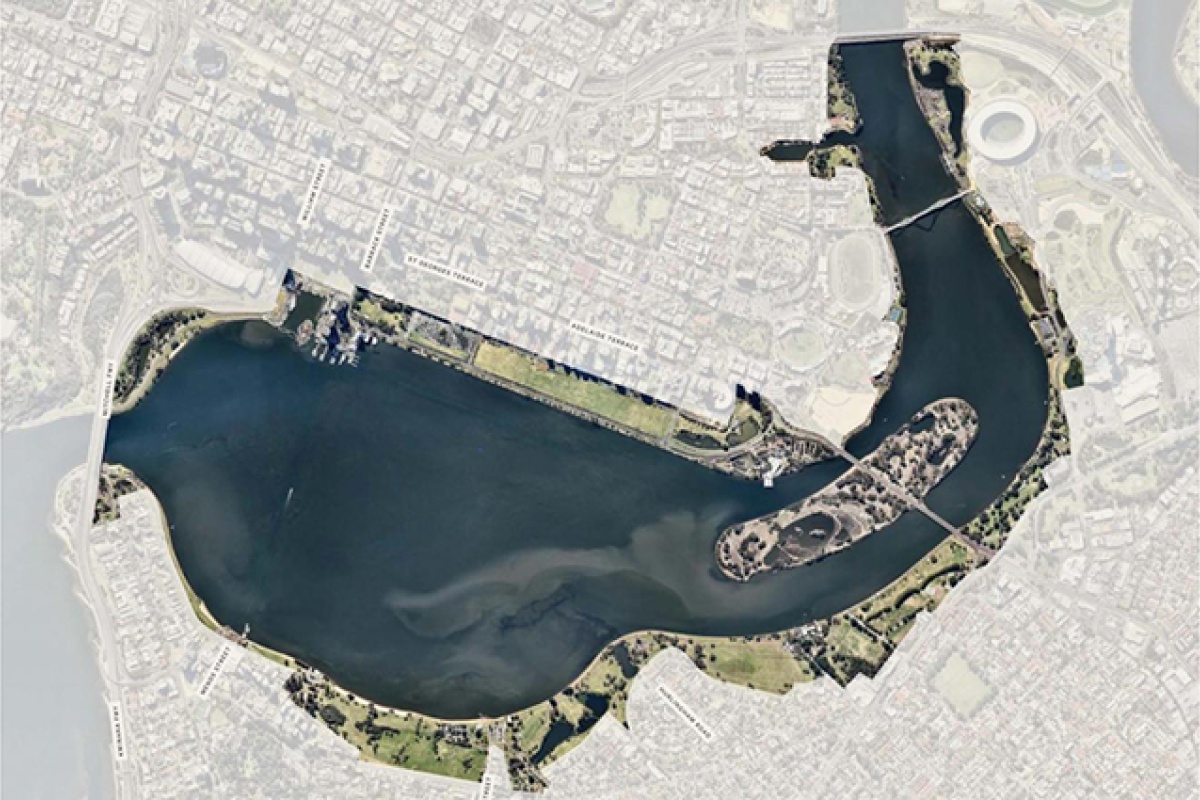
Perth water locality plan area
Perth Water Buneenboro Locality Plan
Supporting documents
Belmont Foreshore Precinct Plan
The purpose of the City of Belmont Foreshore Precinct Plan is to provide the City of Belmont, Department of Biodiversity, Conservation and Attractions, Swan River Trust and Western Australian Planning Commission with a detailed planning tool to guide development and uses within the river setting; and ensure that the landscape values of the river system are conserved or enhanced for present and future generations.
The plan guides the future use and management of the Belmont foreshore and the development interface with the Parks and Recreation reserve.
Draft Locality Policies
Draft Locality Policy and Plans
Foreshore Planning
Ashfield Flats Master Plan
The Department of Biodiversity, Conservation and Attractions (DBCA) prepared the Ashfield Flats Master Plan to provide guidance for future land management and planning for the area.
The Master Plan was prepared following a two-year monitoring program that aimed to identify the dominant hydrological processes at the reserve. The program monitored water flows, surface water and groundwater levels, water and sediment quality, and developed hydrological models.
Ashfield Flats is the largest remaining river-flat in the Perth metropolitan area, on the floodplain of the Swan River. This Bush Forever Site and listed wetland of importance is home to the Subtropical and Temperate Coastal Saltmarsh Threatened Ecological Community (TEC). The TEC is protected under State legislation (Biodiversity and Conservation Act 2016) as well as Federal legislation (Environment Protection and Biodiversity Conservation Act 1999).
The Ashfield Flats Master Plan will play an important role in prioritising the protection of the environment and enhancing the Threatened Ecological Communities (threatened environment) that exist there. Community access to the site is important for recreation, and will need to be balanced against the environmental significance of the site.
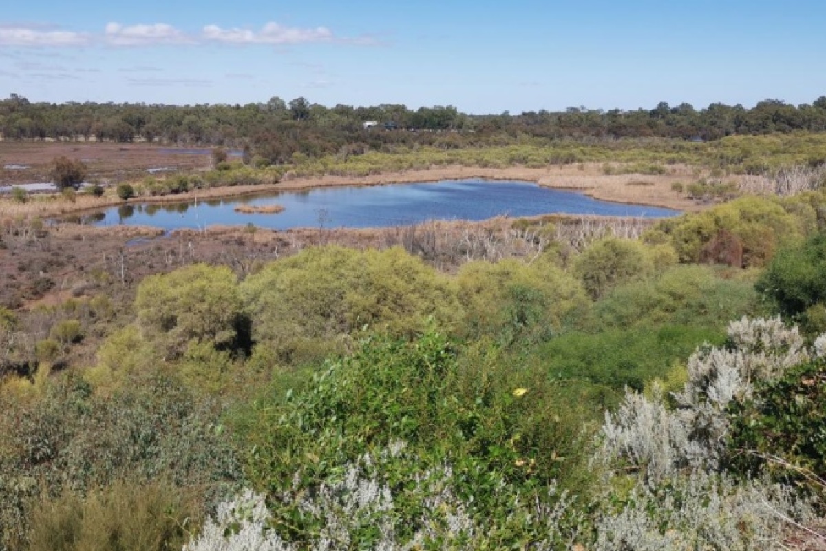
Ashfield Flats lookout
Ashfield Flats Master Plan
Guidelines
Corporate Guideline 40 - Variation or extension of approval: Applying Section 84
If a development approval has been issued the Minister is able to authorise a “minor” variation or extension of that approval through section 84 of the Act.
The wording of section 84 leaves the term ‘minor variation’ open to interpretation. This guideline was developed to set out how Section 84 will be administered and to ensure that it is used for its intended purpose.
The objectives of this guideline are to establish:
- a practice for applying section 84 that reflects its purpose;
- the Trust’s expectations regarding a ‘minor variation’ to an approval;
- the situations where an extension of time for an approval may be supported; and
- the Trust’s role in administering section 84.
This guideline covers:
- The purpose of section 84
- What is considered a minor variation
- Extension of time approval
- Administration of section 84 on behalf of the Minister
- Flow chart of the process
Corporate Guideline 41 - Scientific studies: Applying Regulation 16C of the Swan and Canning Rivers Management Regulations 2007
This guideline applies when a person is considering carrying out a scientific study within the Riverpark or DCA.
A permit under regulation 16C may include approval for minor works, acts and activities required for the purposes of scientific research and investigation, such as:
- taking samples of soil, sediments, water, invertebrates, fauna or flora, and
- installing devices for monitoring of waves, water quality, soil characteristics, sediment or groundwater characteristics,
but does not include the permanent placement of devices or structures in the River reserve – a separate approval would be required for this.
This guideline covers:
- Scientific activities that do not require a permit
- Scientific studies undertaken by DBCA
- Other approvals
- Information to include with an application
- Outcomes of scientific studies
- Advice from other agencies
Best management practices for foreshore stabilisation
The Best management practices for foreshore stabilisation aim to improve foreshore stabilisation management through the following methods:
- Increasing land managers’ knowledge regarding best management practices for foreshore
stabilisation. - Improving the department's understanding of appropriate management responses for foreshore
stabilisation and assisting the strategic allocation of Riverbank Grants Scheme funding.
The documents below include tools to determine appropriate techniques for a given site. The level of detail provided will allow land managers to undertake some stabilisation works themselves and to engage with design engineers for the more ‘engineered’ techniques, thus ensuring all relevant information is considered in the design and that appropriate construction techniques are adopted.
These guidelines do not attempt to cover all aspects of foreshore stabilisation. The information is included as a guide only and it is envisaged that this report will be reviewed as new technologies are developed and the knowledge of how these techniques respond in the Swan Canning river system is expanded.
Guidance Notes and Processes
Guidance Note - Construction Environmental Management Plans
A Construction Environmental Management Plan (CEMP) identifies all the potential environmental risks or impacts that can arise during construction and the measures put in place to manage and minimise these impacts.
A CEMP should be tailored to the project and contain site-specific information.
This guidance note provides a recommended document structure to assist with the preparation of a CEMP for works within the Swan Canning Development Control Area. The guideline is not intended to be a standard template and some items may not be applicable to every project.
Guidance Note - Algal sampling when using a silt curtain
Certain types of algae (e.g. Alexandrium) that are present in the Swan Canning river system may be harmful and pose a threat to public health in the event of an algal bloom.
The conditions created within a silt curtain – still water, a (minor) increase in water temperature and sediment disturbance – may promote algal bloom formation.
This document aims to prevent the spread of algal blooms into the river system. Guidance is provided on monitoring and sampling when conducting works within a silt curtain and/or works that disturb riverbed sediment.
Determination Processes
The Determination Processes document outlines the statutory planning responsibilities of the Department of Biodiversity, Conservation and Attractions and the Swan River Trust in relation to the DCA. It details the determination processes associated with the SCRM Act and SCRM Regulations and those proposals subject to control under the Metropolitan Region Scheme.
Landscape descriptions
The Swan Canning river system is integral to Perth's cultural and environmental identity. The river system has a natural beauty that must be preserved and managed for the enjoyment of all Western Australians, as well as for visitors to our State.
The landscape descriptions are designed to encourage and assist the protection and enhancement of the character and beauty of the environment by highlighting the main landscape elements. These documents present detailed resource and landscape character descriptions for the Swan and Canning rivers and their major tributaries. Biophysical elements, past and present land uses and sites of significance are all summarised.
